Remote sensing and change detection
Spectral band combinations, NDVI and riparian encroachment mapping from Landsat and aerial imagery
Academic coursework / 2021-2022
Notes on method
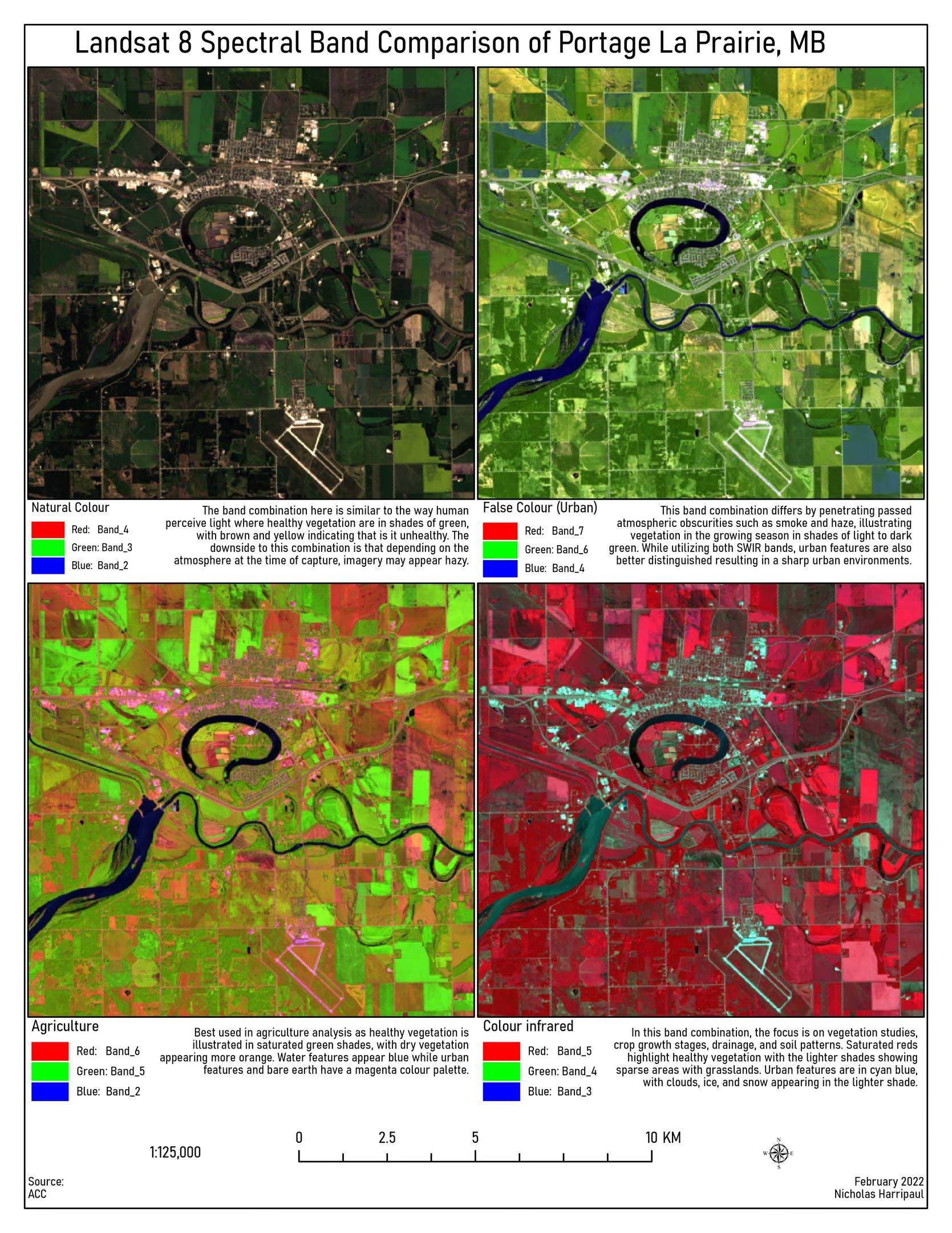
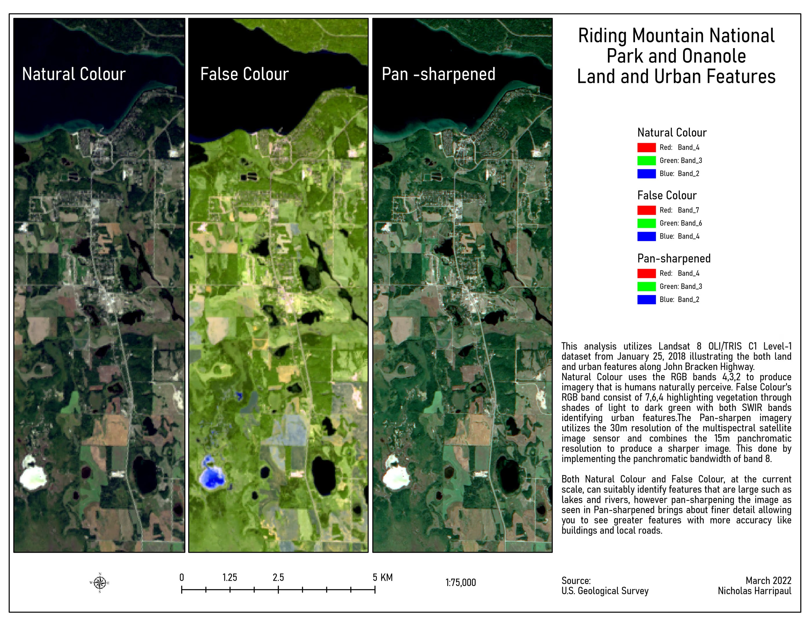
A multispectral scene contains more than a person can look at, so the first decision is which three bands to put in the three colour channels. The comparison plate makes that decision visible: vegetation separates cleanly in one combination, built surfaces in another, bare soil in a third, and none of them is the right answer in general.
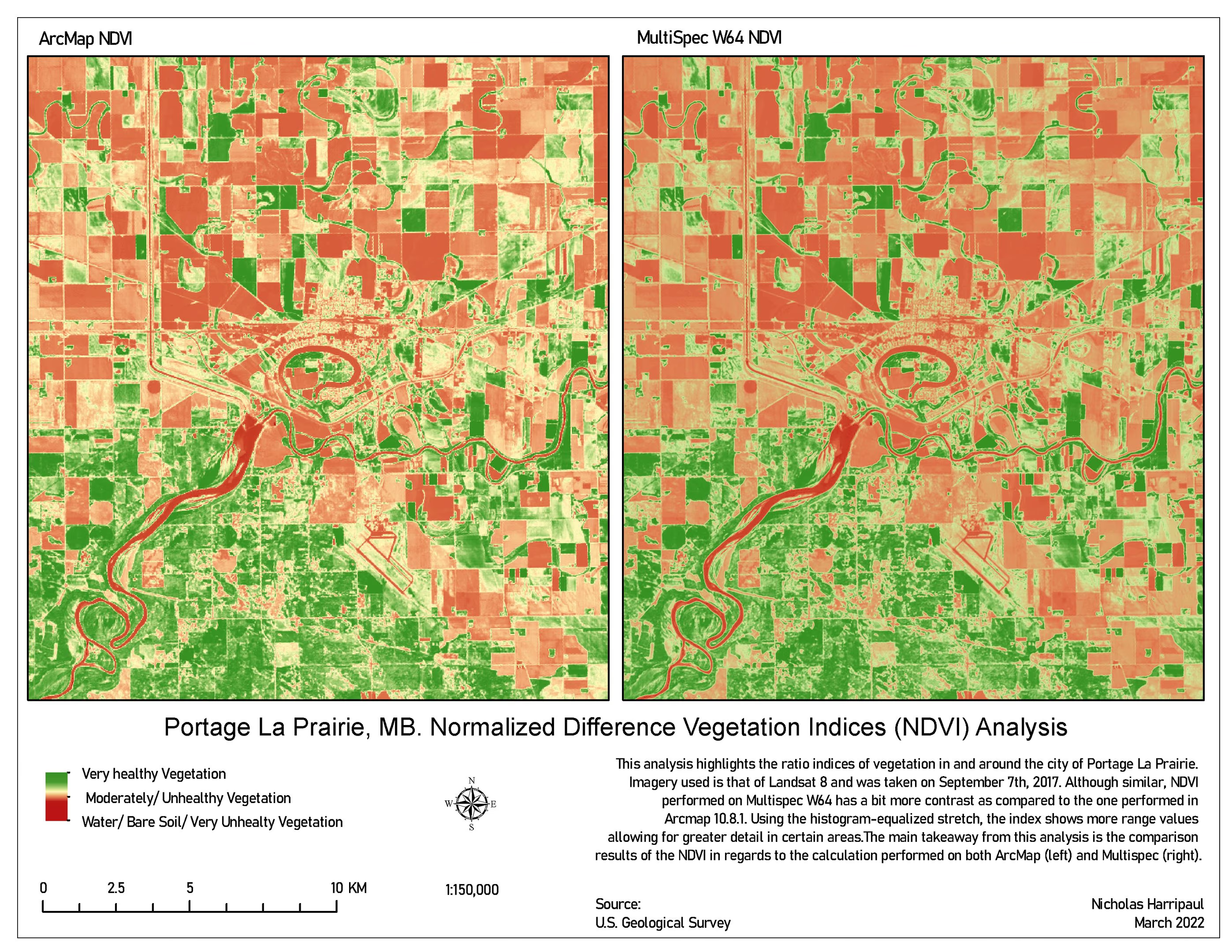
NDVI is the compression of that question into one number per pixel, which makes it comparable across dates and is why change detection uses it.
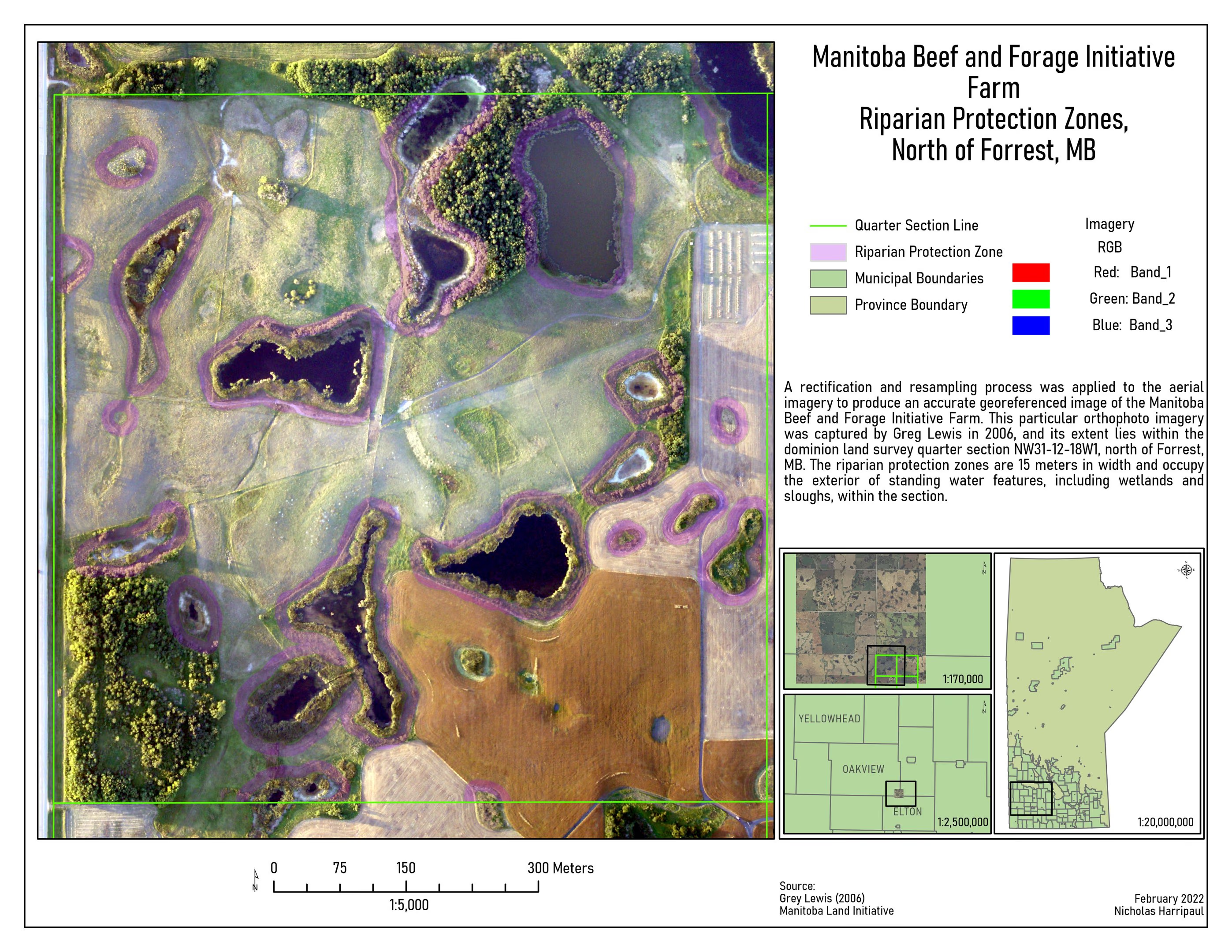
The riparian work is where the imagery becomes a decision. A protection zone drawn at 1:5,000 is something a producer can act on; the same zone at a provincial scale is a policy statement. Mapping encroachment on protected land means being willing to show where a boundary has been crossed, which is a different task from mapping where the boundary is.