11 projects. 25 plates.
Coursework from the GIS program that preceded the professional work. Every figure is one I made, at print resolution, with its data source named and nothing cropped away, so the credits printed in the map margins stay where the cartographer put them.
These are academic projects, produced during the GIS program at Assiniboine Community College between late 2021 and early 2022. They are labelled as coursework throughout, because the alternative is letting a reader assume otherwise. Dated work that says what it is beats undated work that lets you guess.
This is the oldest material on the site and the least representative of current work. Years of production geospatial and commercial analysis followed it; that is on Experienceand Leadership, described as closely as commercial confidentiality allows.
Where a model stops being defensible.
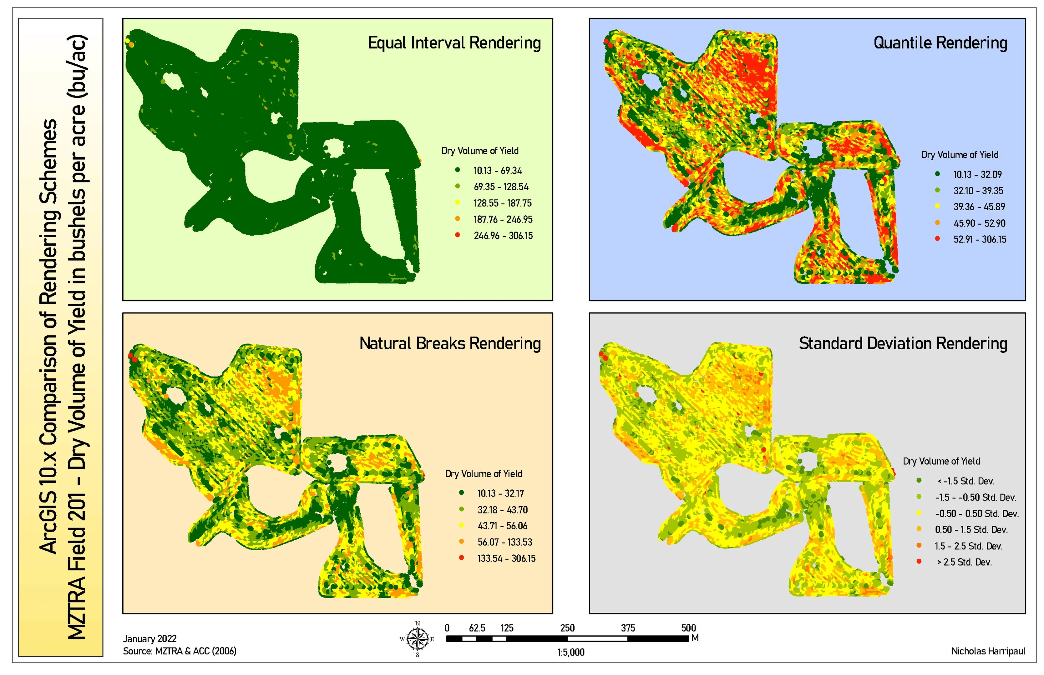
Four ways to render one field
The same yield data classified four ways, where equal-interval collapses almost the entire field into a single class
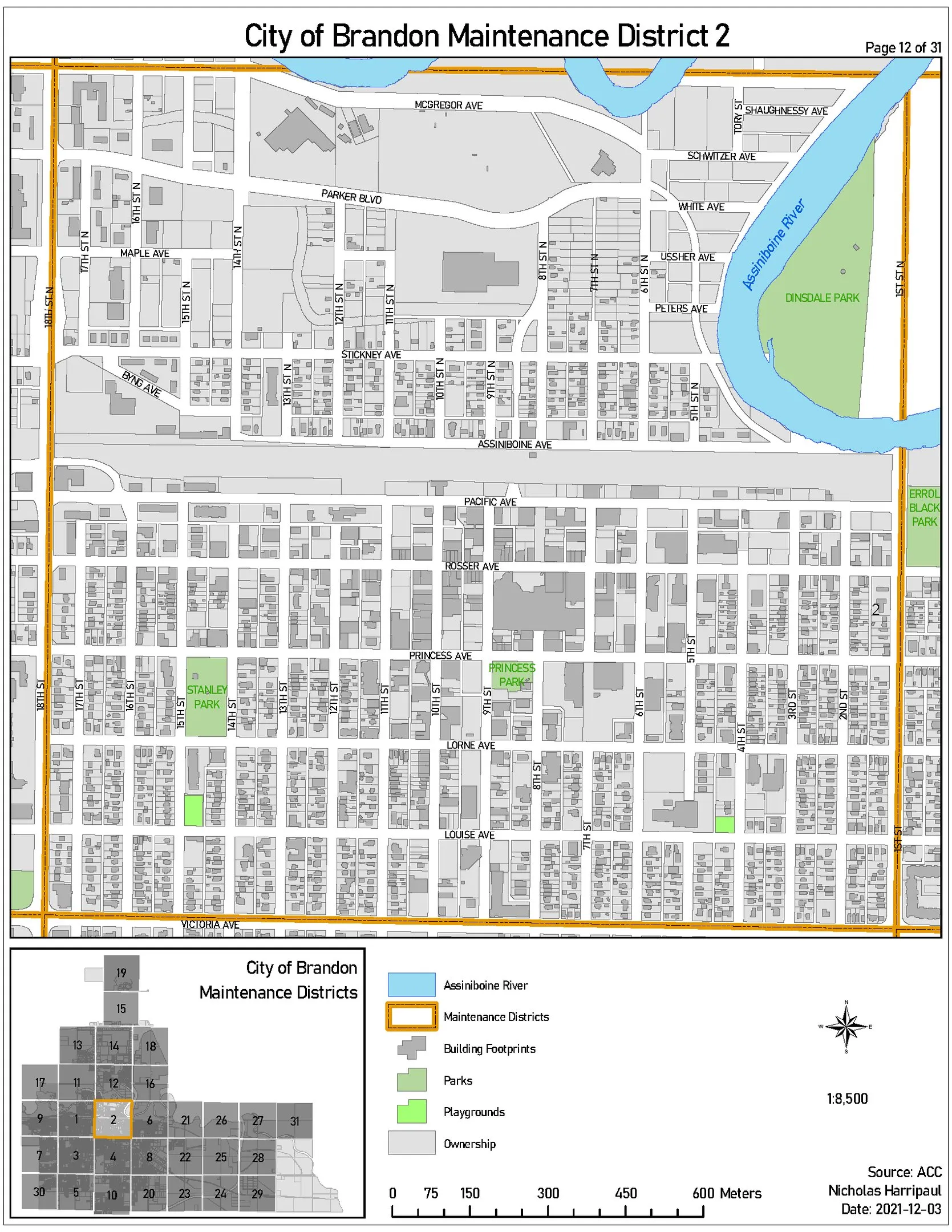
City of Brandon maintenance districts mapbook
A 31-district municipal mapbook: consistent symbology and index across every page, so any crew can read any sheet
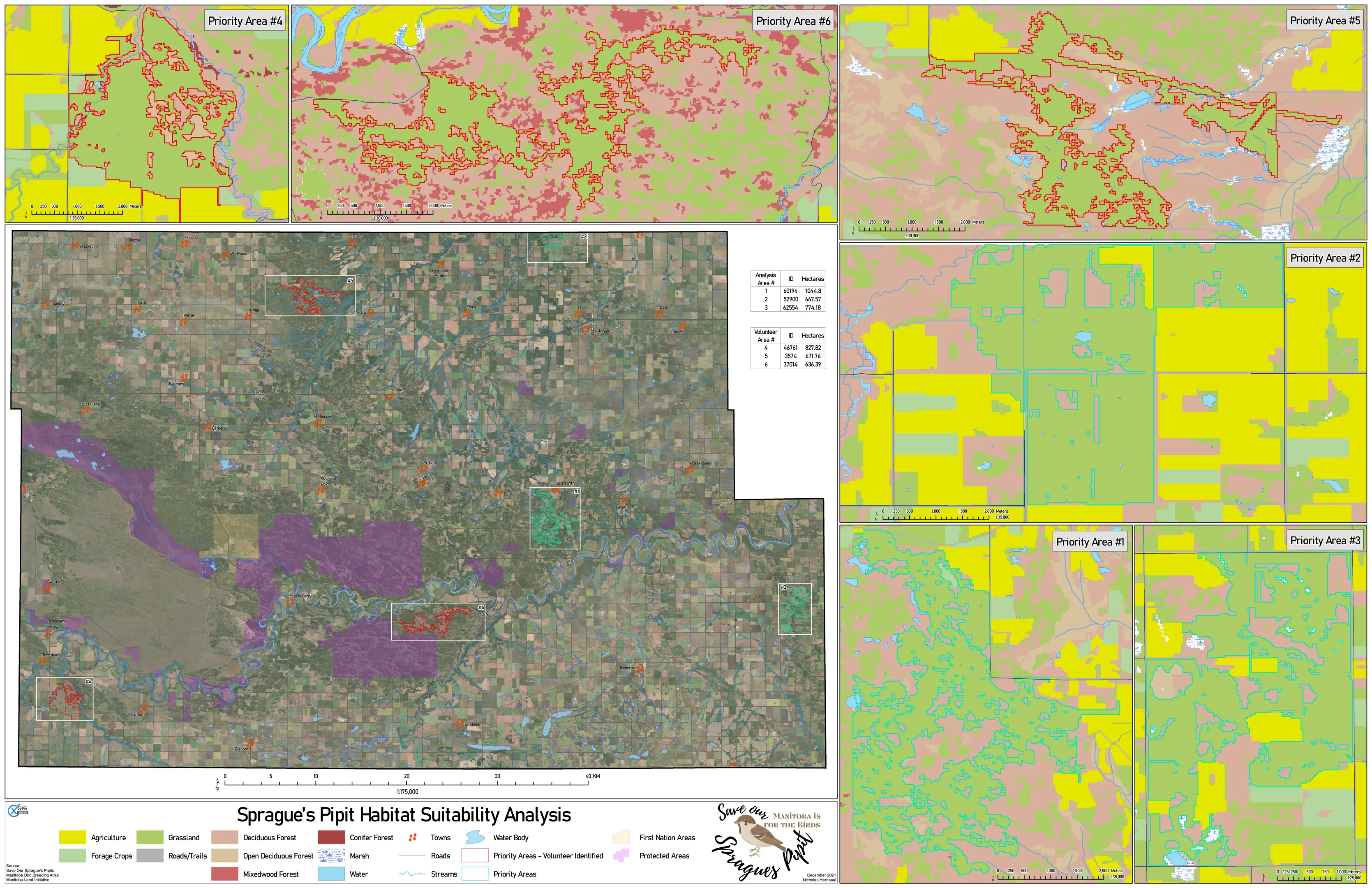
Sprague's Pipit habitat and corridors
Capstone: a grassland songbird's habitat distribution modelled from land cover, terrain and occurrence records
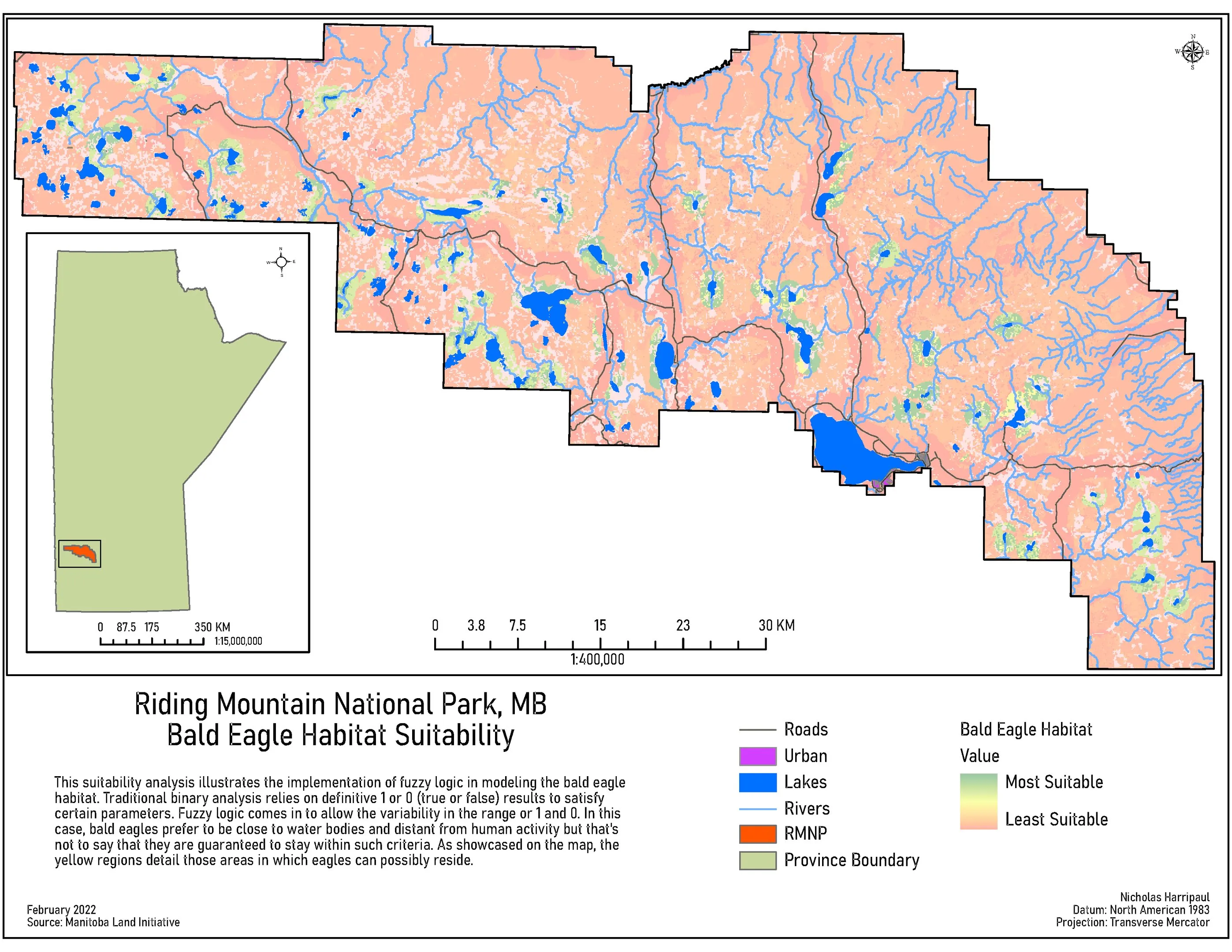
Bald eagle habitat suitability, Riding Mountain
A fuzzy-membership suitability surface, built because the binary version answered a question nobody asked
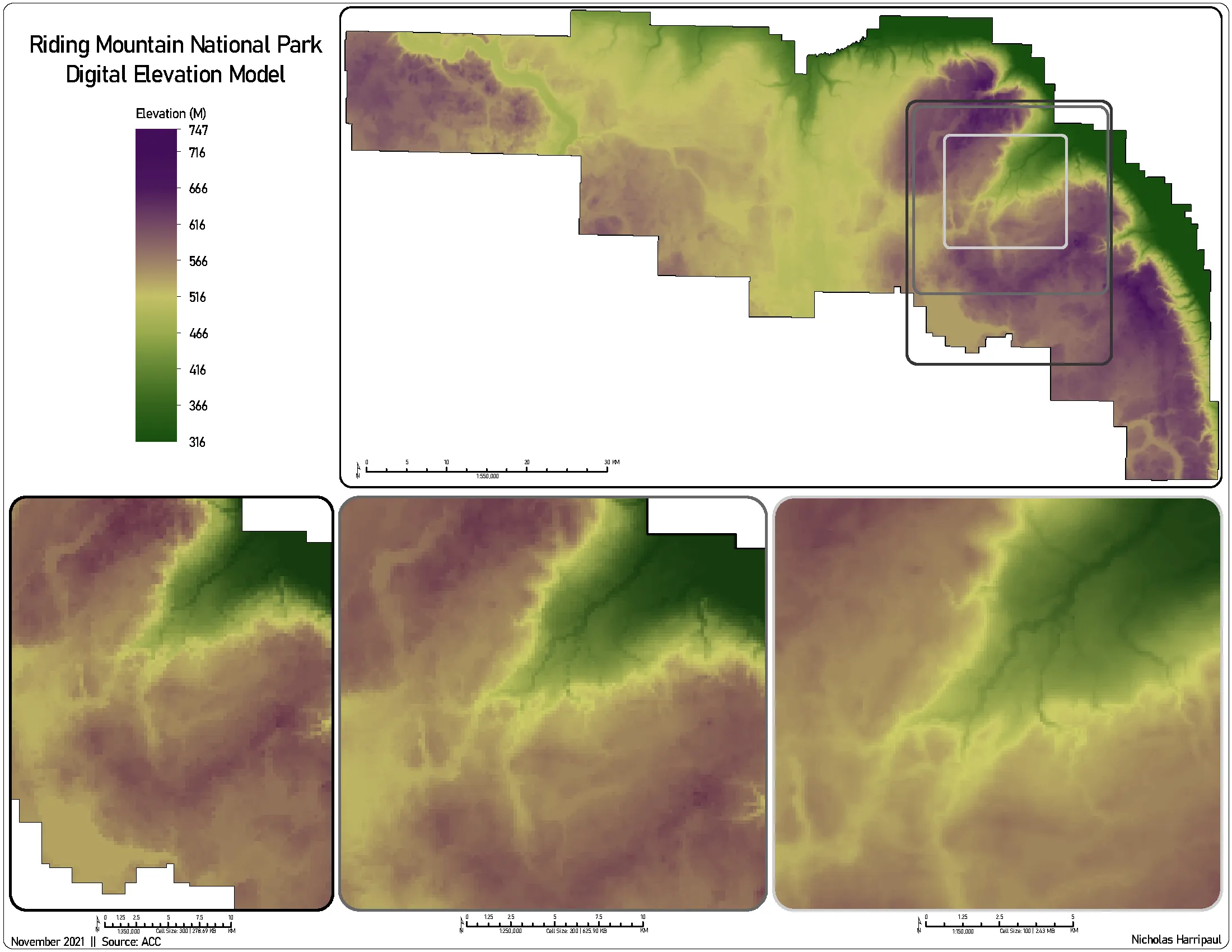
Terrain modelling from LiDAR
Elevation, slope, aspect and isarithmic profiles across four Manitoba study areas, from raw point cloud up
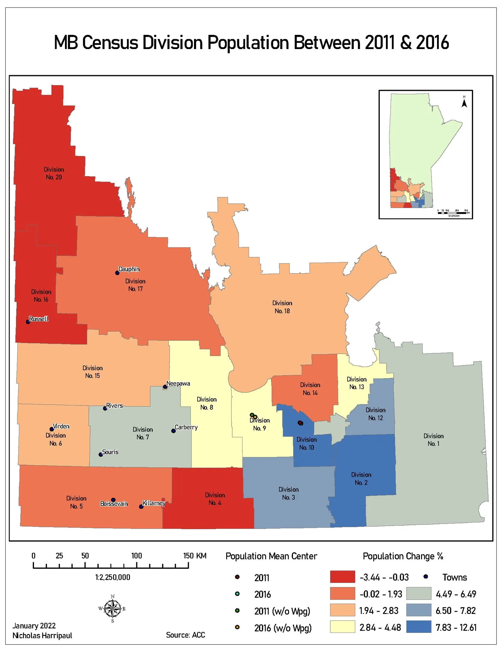
Manitoba population change, 2011 to 2016
Census division change, with the population mean centre computed twice: once with Winnipeg, once without
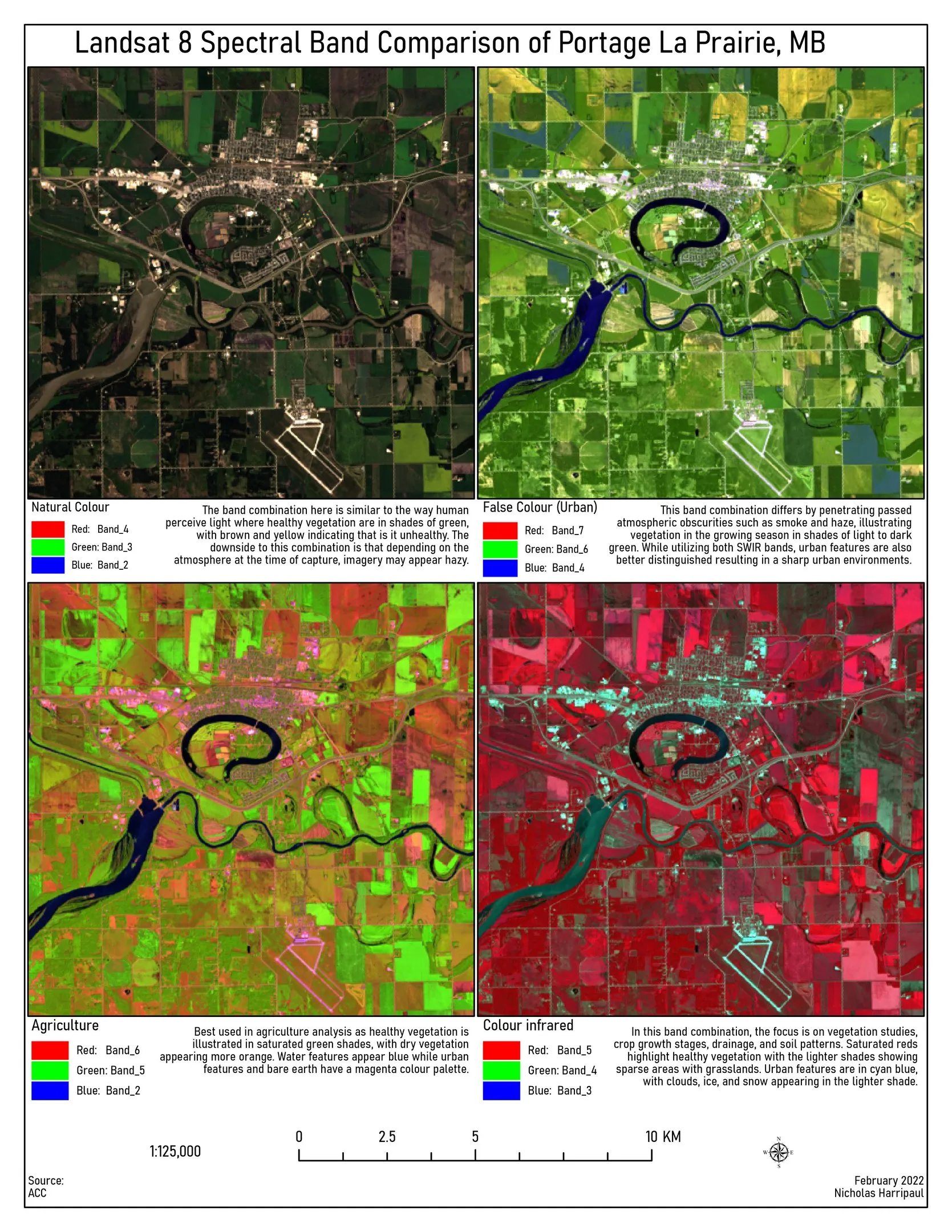
Remote sensing and change detection
Spectral band combinations, NDVI and riparian encroachment mapping from Landsat and aerial imagery
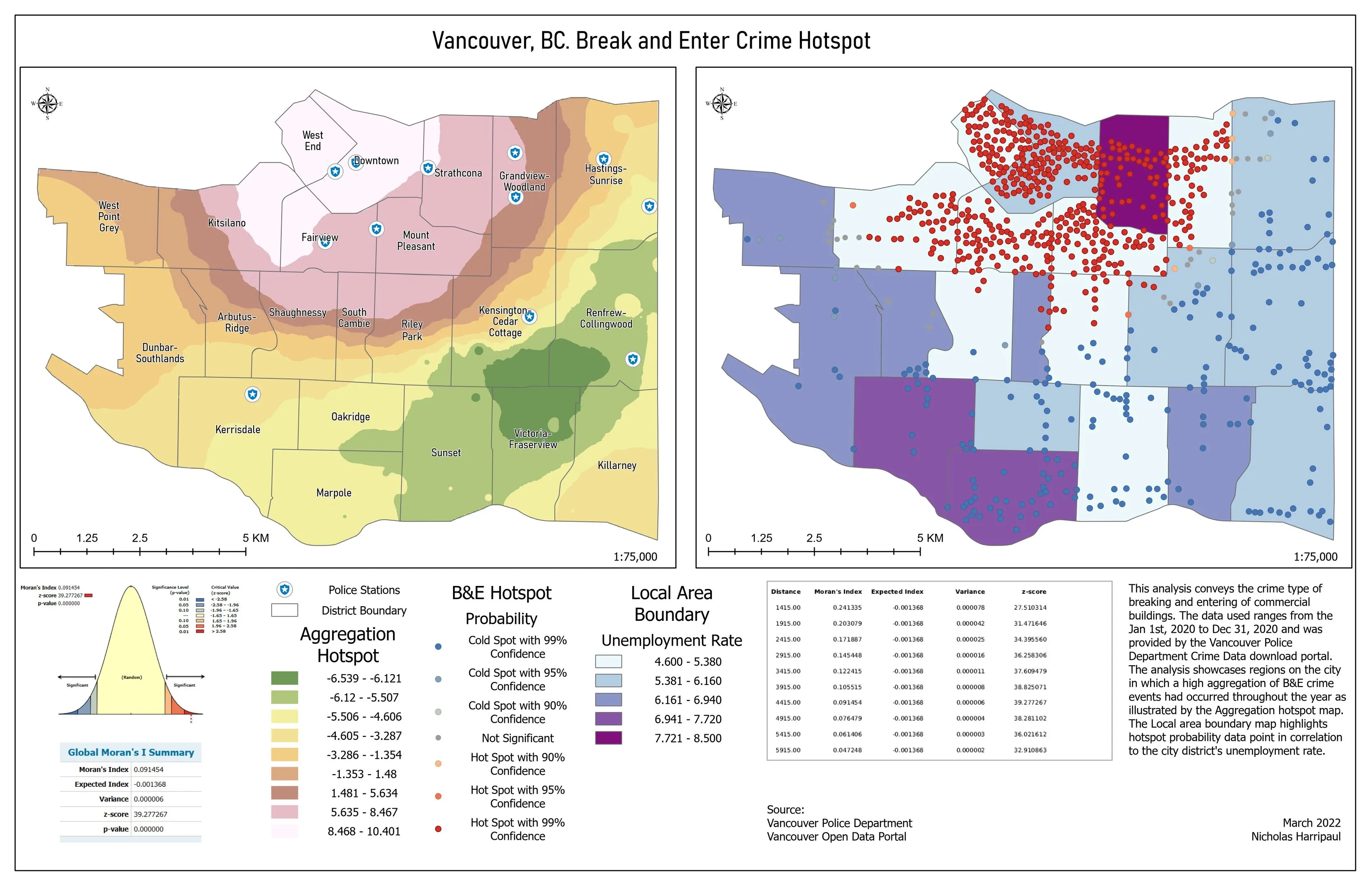
Vancouver break-and-enter hotspots
Getis-Ord Gi* on geocoded police reports, with the global statistic reported alongside the map
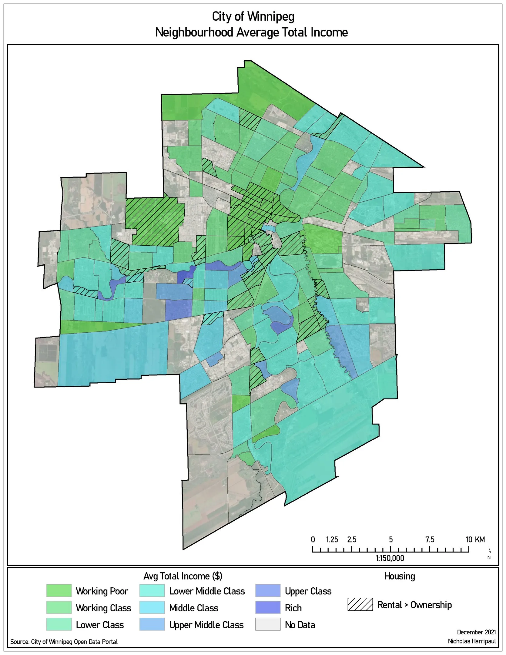
Winnipeg neighbourhood income
Average total income by neighbourhood, classified into named income bands rather than numeric quantiles
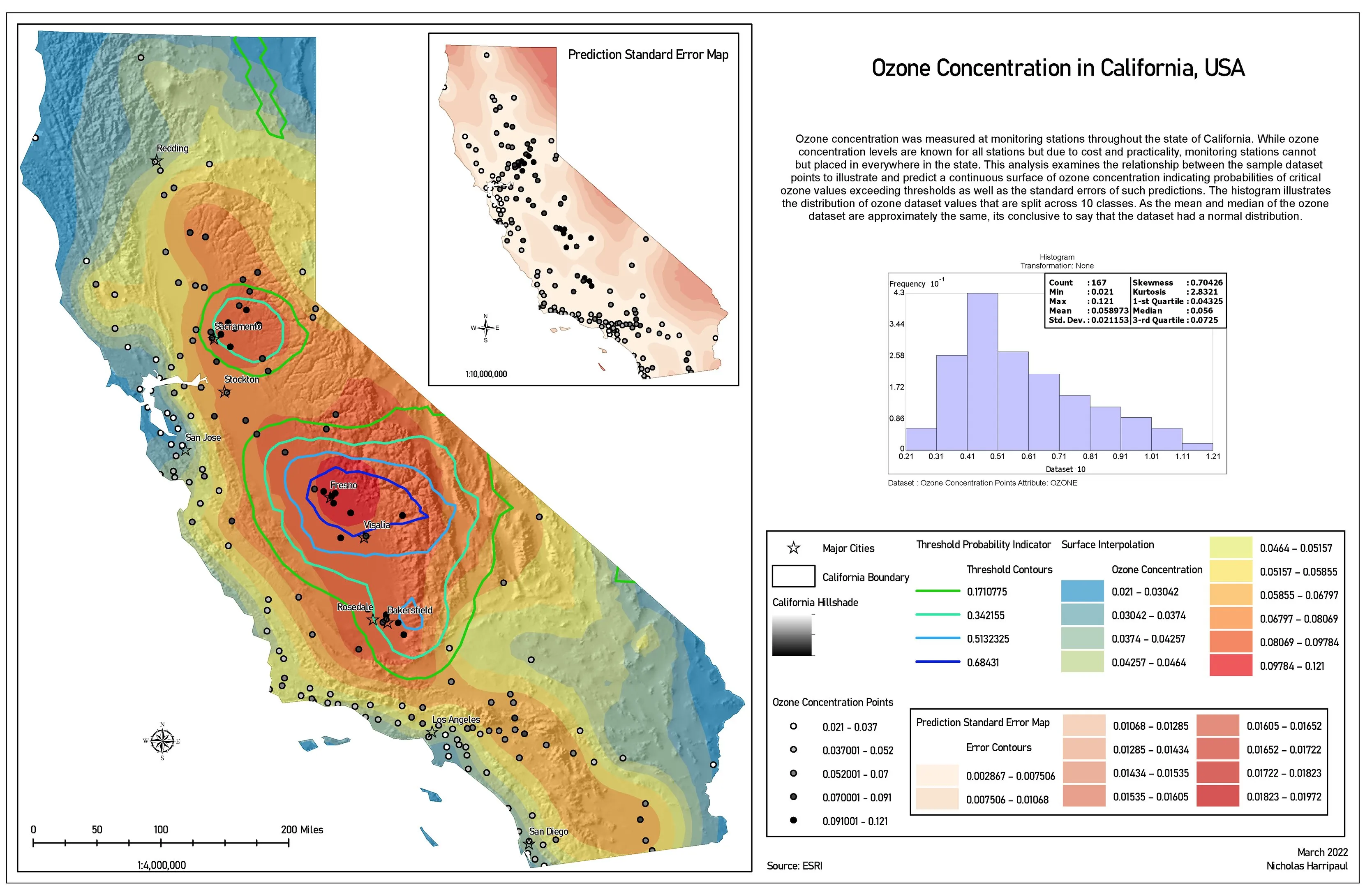
Ozone concentration across California
Ordinary kriging from sparse monitoring stations to a continuous surface, against the health standard
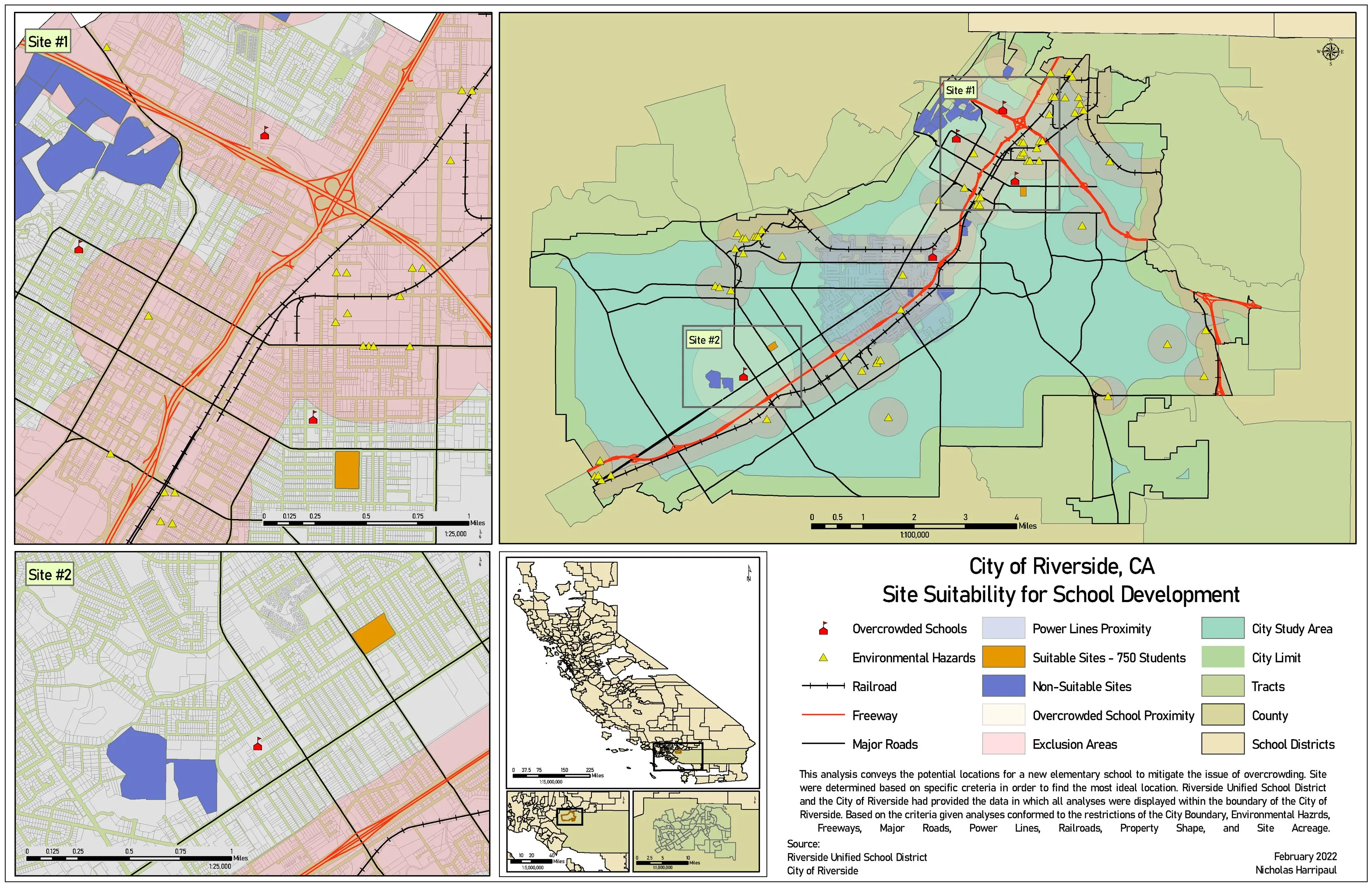
Elementary school siting, Riverside
Multi-criteria siting across census, zoning, road, hazard and natural-feature layers on one suitability scale