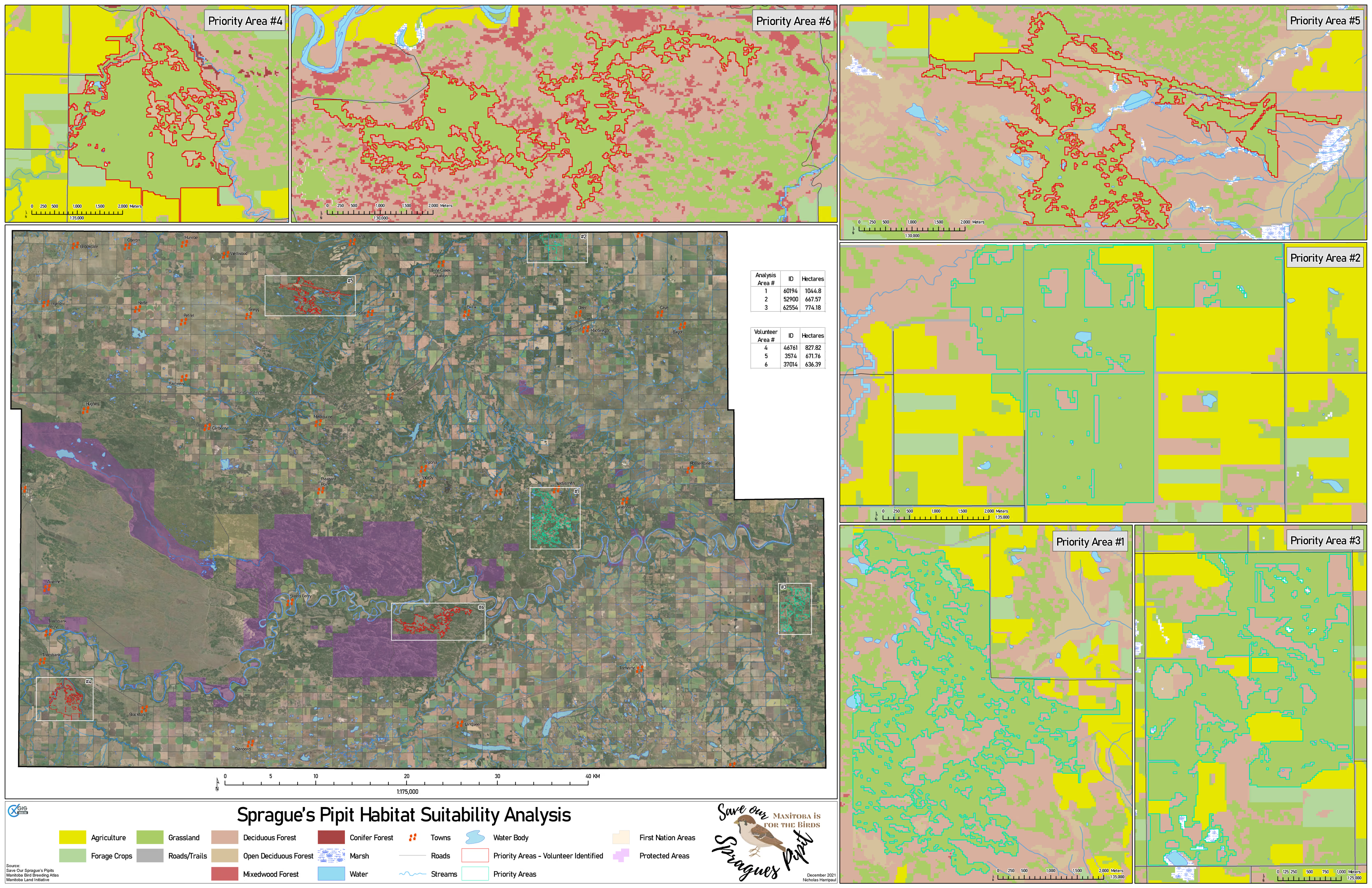
Sprague's Pipit habitat and corridors
Capstone: a grassland songbird's habitat distribution modelled from land cover, terrain and occurrence records
Academic coursework / December 2021
Notes on method
Sprague’s Pipit nests in native grassland, which in southern Manitoba is mostly gone, converted, or fragmented into pieces too small to hold a breeding territory. Modelling where the bird can live is therefore less about finding good habitat than about finding the remnants and asking whether they connect.
Land cover came from satellite imagery, classified into the categories the species actually responds to rather than the categories the source data shipped with. Elevation and slope from LiDAR excluded terrain the bird does not use. Occurrence records sampled from atlas and volunteer survey data anchored the model to places the species has actually been seen.
Volunteer-identified priority areas are kept as their own layer rather than merged into the suitability score. They are observations, not model output, and combining the two would make it impossible to tell afterwards which areas the model found and which it was told.